OVERVIEW
The FYB Mediazel utilizes several Google Cloud Platform API's for some of its features:
- GOOGLE VISION API
- GOOGLE SPEECH TO TEXT API
- GOOGLE MAPS API
The API's are not free to use, Google charges for these services on a per-usage basis. However unless Mediazel is used extremely heavily in your organisation, it is unlikely you will hit the usage limits and incur charges. All pricing information can be found in the sections below.
GOOGLE VISION API
The Google Vision API allows us to automatically detect objects, text and labels when uploading images to Content Manager through Mediazel. The objects that the API detects are automatically added as tags to the records in Content Manager. The tags are searchable and allow users to find their images more easily.
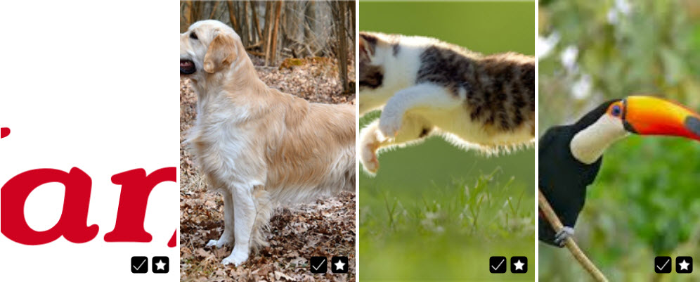
For example, the below four images are uploaded to Mediazel.

Images as they appear in Content Manager - Notice they've been automatically tagged and can be searched on via any of the terms within the tags field.

Additional information: https://cloud.google.com/vision/?hl=en_US
Pricing information: https://cloud.google.com/vision/pricing
The google vision API only makes use of the LABEL_DETECTION feature. When refering to pricing information above this is the only feature being used.
GOOGLE SPEECH TO TEXT API
The Google Speech to Text API is similar to the Vision API but for audio. Whenever a user uploads an audio file through the Mediazel, the audio will be automatically converted to text. You are then able to search on the words spoken from the audio file.
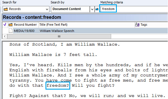
For example, the below audio file was uploaded through Mediazel and it has automatically converted the audio to an OCR text rendition in Content Manager. This then allows you to perform searches on the text.

Additional information: https://cloud.google.com/speech-to-text/docs/quickstart-protocol?hl=en_US
Pricing information: https://cloud.google.com/speech-to-text/pricing
GOOGLE MAPS API
The Google Maps API allows Mediazel to perform GPS searches and display records on an interactive map.
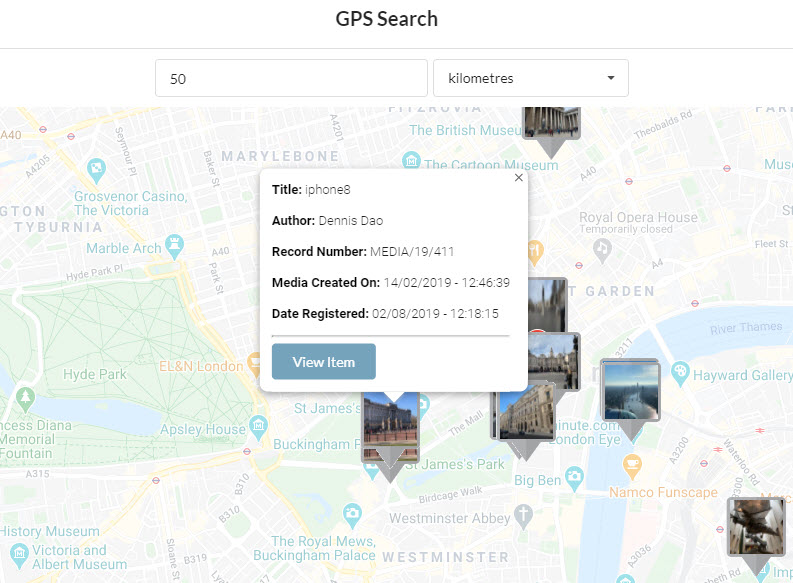
For example, the below search is looking for all images within a 50km radius of London. Any images taken from within this area will be displayed on the map. Users can click on the image to retrieve additional details.

Additional information: https://developers.google.com/maps/documentation/javascript/overview
Pricing information: https://developers.google.com/maps/documentation/javascript/usage-and-billing